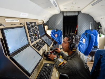
OUTIL D'AVERTISSEMENT PRÉMATURÉ DU TSUNAMI POUR LA ZONE CARTOGRAPHIQUE

The officer shows the latest earthquake location on the earthquake and tsunami-nied warning tool monitor or Warning Receiver System (WRS) installed in the BPBD Office of Padangpariaman District, West Sumatra, Monday (19/7/2021). BPBD Padangpariaman a reçu le WRS InaTEWS (Indonesia Tsunami Early Warning System) dernière génération de BMKG qui fournira des informations d'alerte rapide sur le tremblement de terre et le tsunami (temps réel) étant donné que le quartier a 140 kilomètres de côtes en cas de catastrophe. ANTARA PHOTO/Iggoy el Fitra/wsj.
The caption is automatically translated by application. Click here for the Bahasa Indonesia version.
Photo associée
Tags:


